PROJECT SUMMARY:
Identification & Measurement of NFT Areas
Marin Municipal Water District (MMWD)

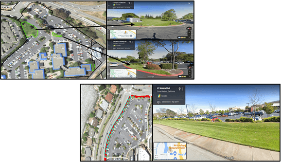
DCSE created a machine learning classification model to apply on high-resolution NAIP imagery of 2018 and identify the irrigable areas. Irrigable areas consisted of turfgrass (healthy green, plus yellow/dead vegetated areas) and trees covering the grass throughout the district’s service area.
Next, NFT candidates were obtained through a comprehensive model, including automated, manual, and visual processes, developed to refine the map of irrigable areas.

By identifying these locations of NFT that provide little or no recreational or community benefit, DCSE can visualize and inform MMWD of areas to target their conservation efforts tied to removing such turf. The polygon outputs serve as a basis to evaluate how impactful removal efforts will be and quantify monetary as well as environmental benefits.
HIGHLIGHTS
- Distinguishes commercial and industrial NFT
- Query, analyze, and visualize NFT at the parcel level and across several imagery sources
- Identify turf locations representative of inefficient water consumption
BENEFITS
- Enables a water district to visualize, locate and measure purposeless grass areas and transform it into targets for efforts to ban NFT
- Supports action to reduce demand on local reservoir
PROJECT OWNER
- Marin Municipal Water District (MMWD)
REQUEST MORE INFORMATION
LOCATION
DCSE Inc.
23461 S. Pointe Drive
Suite 300
Laguna Hills, CA 92653
© 2024 DCSE Inc. All Rights Reserved

