PRODUCT SUMMARY:
GIS-Enabled Asset Registry (GEAR)
A GIS-Enabled Asset Registry (GEAR) For Vertical Assets
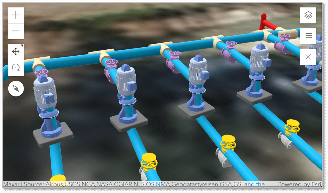
GEAR is a user-friendly, GIS-Enabled Asset Registry designed specifically for managing vertical assets that are included in Utility Network. GEAR is ideal for asset managers without GIS experience, simplifying the management of vertical assets in a Utility Network. Leveraging the 3D capabilities of the Utility Network data model, GEAR offers a digital twin interface for comprehensive management of vertical assets.

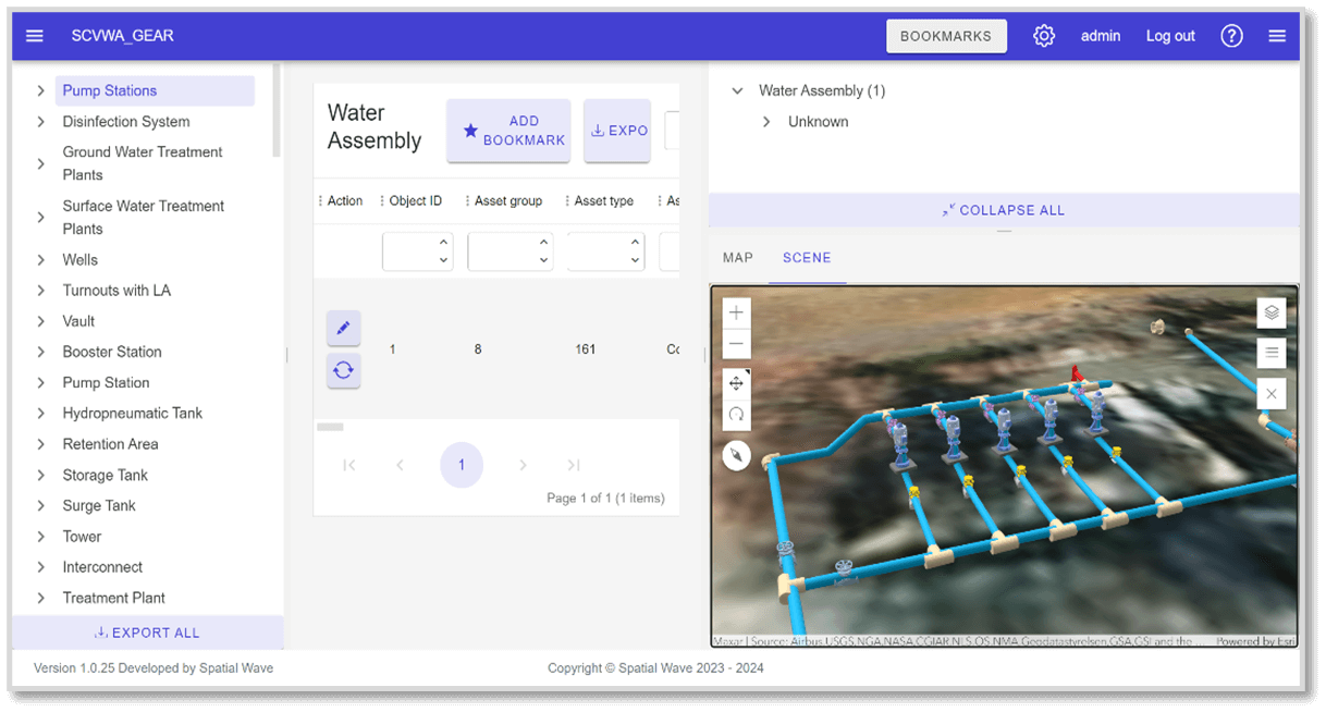
View of GEAR looking at a Digital Twin of a Booster Station
Specifically tailored for water utilities, GEAR seamlessly integrates with GIS-centric asset management solutions that are compatible with utility networks. GEAR also enables the GIS experts that work directly on Utility Network to work jointly with non-GIS experts that are responsible for managing the vertical assets. GEAR includes capabilities to display vertical assets in 2D and 3D formats.
Interactive features in GEAR allow users to select assets via 2D or 3D views and see their selection reflected across all interfaces, enhancing navigation and visualization. This capability allows the users to quickly navigate to the area of interest and to view the vertical assets of interest. If the vertical asset is related and does not have geometry, then it can be navigated to in the main GEAR tabular interface. GEAR supports updating existing assets, adding new non-GIS but related assets, replacing existing assets (with GIS geometry) in place, e.g., replace an existing Pump at a booster station.
To start using GEAR, we first expand your Utility Network data model to incorporate vertical assets into your asset registry. Once the setup is complete, connect GEAR to the designated branch version of your Utility Network, preparing it for user operations.
Any modifications made by GEAR users undergo quality assurance review before being transferred to the Utility Network’s default version, which maintains the most current, approved state of the data.

3D View of the Utility Network
You must be registered as an Esri named user with editing capabilities for the Utility Network to fully utilize GEAR. If your role is set to a viewer, you can still use GEAR to connect to the Utility Network and access the vertical assets for browsing purposes.
Additionally, GEAR serves as a central hub to integrate related data such as engineering drawings, SCADA data, and asset management records, enhancing your asset management strategy.

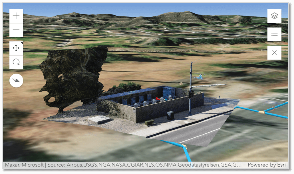
3D View of the Utility Network & Drone Based Reality Capture
HIGHLIGHTS
- GEAR: Powering Precision in Asset Management
- Manage Vertical Assets in Utility Network
- Manage Vertical Assets with minimal GIS Expertise
- Use Utility Network as the complete Asset Registry of your Network
BENEFITS
- Enhanced Usability: GEAR provides a user-friendly interface for Data editing
- 3D GIS Support for “Vertical” Assets
- Supports All Utility Network Data Models and Extensions
- Simple to Use and Understand
- Collaboration Enhanced: GEAR bridges the gap between GIS experts & non-GIS asset managers, facilitating collaboration
WHO SHOULD USE
- Utility Network Administrators
- Vertical Asset Managers
REQUEST A DEMO OR MORE INFORMATION
Let us know by filling out our form through the Contact Page link below.
LOCATION
DCSE Inc.
23461 S. Pointe Drive
Suite 300
Laguna Hills, CA 92653
© 2024 DCSE Inc. All Rights Reserved

