Irrigation System Mapping
OVERVIEW –This may helpful if you are looking to answer questions such as:
- Which headgates do you need to open to irrigate a field?
- Which fields are impacted by closing a certain gate?
- How does an individual gate opening, or closure impacted all of the field in the district?
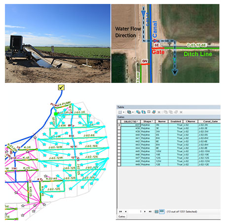
DCSE has mapped the network of irrigation system and of water deliveries infrastructure through the valley, and developed a Geometric Network of water delivery system for the entire Irrigation District.
- We use a combination of multi-temporal satellite and airborne imageries and parcel-gate associations information to capture and digitize the water delivery infrastructures.
- We design a Geometric Network to track water deliveries from Dam (source)-to-Canal-to-Gate-to-Ditch-to-Parcel or Farm, and vice versa.
The water distribution network can be used by an Irrigation District to perform spatial and statistical analysis through the tracing of water flow from upstream or downstream of a given node/head-gate. The network assists district to model the local water supply network through the interconnectedness of geospatial infrastructure features.
WATCH THE VIDEO DEMONSTRATION HERE:
REQUEST A DEMO OR MORE INFORMATION
Reach out to us to learn more about the benefits of IRRIGATION SYSTEM MAPPING for your agency.
LOCATION
DCSE Inc.
23461 S. Pointe Drive
Suite 300
Laguna Hills, CA 92653
© 2024 DCSE Inc. All Rights Reserved


