PROJECT SUMMARY:
Managing Linear & Vertical Assets in Utility Network
Santa Clarita Valley Water (SCVWA)
Santa Clarita Valley Water (SCVWA) was formed in 2018, SCV Water is home to three water divisions: the Newhall Water Division, the Santa Clarita Water Division, the Valencia Water Division, as well as Castaic Lake Water Agency (the regional water wholesaler).
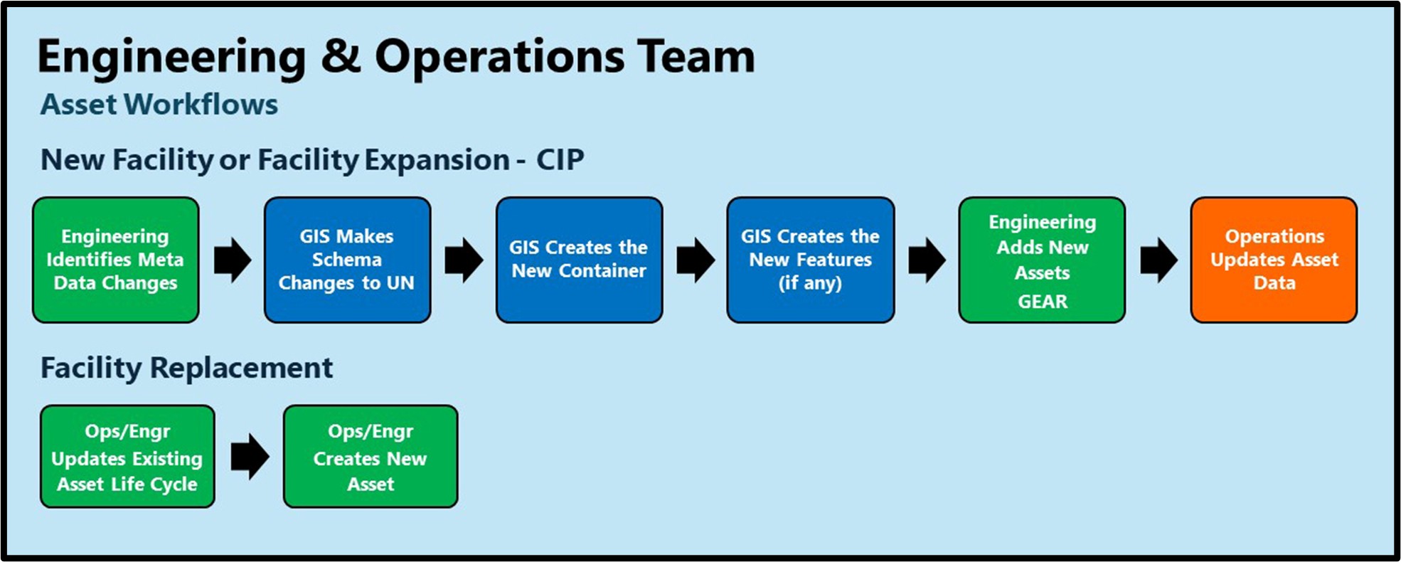
SCVWA envisioned creation of a GIS-Enabled Asset Registry (GEAR), which will be used as the source of data and attributes for all water facilities.

This system will be used as the system of record for naming, identifying, locating, and visualizing all system assets. This will include the Agency’s linear and vertical (plant) assets. Systems that need asset data, e.g., Asset Management System (AMS), Work Order Management, and Data Collection System, will use the GEAR as the system of record for naming and identifying assets. The advantage of using the asset registry will be in the following areas:
- A single and common source of truth for the assets
- Ability to collect and relate data for the same asset from different system
- Ability to visualize locations of the assets given the GIS nature of the system
- Ability to maintain and use the connectivity relationship of the assets
- Ability to maintain different hierarchies based on the needs of the target systems
- Ability to use the Asset Registry in CMMS/AMS system that uses GIS as the source of Asset data
The scope of this work spanned the asset data in GIS (linear) and non-GIS systems. The timing and progress of this project need to be aligned with the future development of the GIS.
In addition, the data update processes currently in place in the source data needed to be aligned with the outcome of this project had to have the most recent and up-to-date data. The project was broken up into two phases:
- Phase 1 – Build the Data Model and Include Vertical Assets
- Phase 2 – Add the Linear Assets from GIS to the Data Model

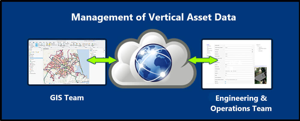
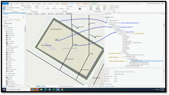
The data model used for this project was Esri’s Utility Network, a modern data model proposed by Esri for Utilities. In Phase 1, this data model was expanded to cover linear and vertical assets, but only vertical assets were loaded into the system. In Phase 2, the linear assets were converted from the existing GIS data model to Utility Network and loaded into the system. The system included a simplified web interface for those managing and maintaining the vertical assets (i.e., Engineering and Operations) to easily update the asset data in Utility Network without a deep knowledge of GIS.

HIGHLIGHTS
- Utility Network Used to Manage Both Linear and Vertical Assets
- Non-GIS Based Web Interface for Managing Vertical Assets
- Extended Water Asset Package Data Model to Manage Vertical Assets
BENEFITS
- Single Asset Registry in UN
- Ability to use GIS Enabled Asset Management System to Model All Assets
- 3-D
- Digital Twin Enablement
PROJECT OWNER
- Santa Clarita Valley Water (SCVWA)
REQUEST MORE INFORMATION
Want to learn more about this Project, or how DCSE can provide similar services for your organization? Let us know by filling out our form through the link to our Contact Page below.
LOCATION
DCSE Inc.
23461 S. Pointe Drive
Suite 300
Laguna Hills, CA 92653
© 2024 DCSE Inc. All Rights Reserved

