PROJECT SUMMARY:
Utility Network Pilot for Sewer System
Elsinore Valley Municipal Water District (EVMWD)
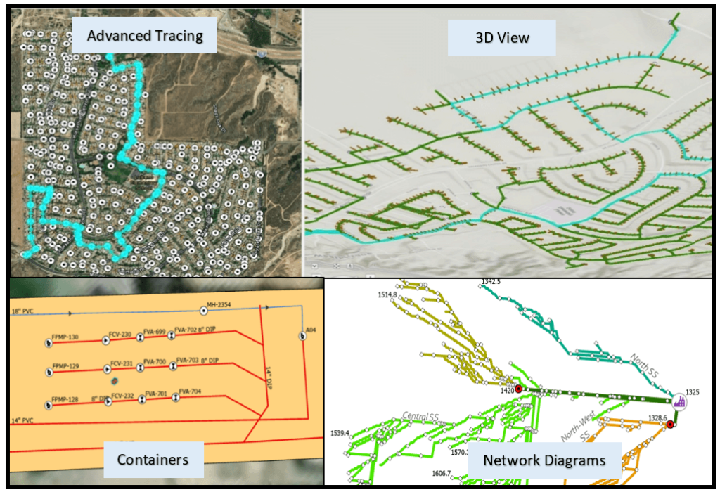
DCSE performed a Utility Network pilot study for Elsinore Valley Municipal Water District’s (EVMWD) sewer system. As part of the project, DCSE migrated EVMWD’s sewer data into the Utility Network. DCSE, using elevation data from the county, assigned z-values to all vertices in the network. Within the network, DCSE also configured subnetworks for use in tracing. The resulting solution included the ability to do connectivity and upstream/downstream tracing and then created a network diagram reflecting the sewer pipes participating in the trace.

The Utility Network conversion resulted in additional Q/A and accuracy not present in the original model. Utility Network implementation resulted in the setup of connectivity rules which enforce the accuracy guidelines as we advance. Network diagram symbolization is an excellent technique to identify inaccurate pipe diameter attributes. This becomes obvious when two smaller pipes are connected with a larger diameter pipe in the middle. 3D modeling of the sewer facilities provided a great visualization tool to understand the gravity and force main flows. The lessons learned from the pilot system included:
- Advanced capabilities of Utility Network – 3D, Containers, Subnetworks, and network diagrams need configuration but are worth the effort.
- Migration requires mapping out source and destination – redo is anticipated, but Esri tools are beneficial.
- The data model is at a mature level and can be extended.
- Licensing is required to use the utility network in the enterprise.
- Esri is making it easier to implement, maintain, and use Utility Network; new functionalities or improvements of existing functionalities are coming soon.
HIGHLIGHTS
- Utility Network Pilot
- Sewer Systems
- 3D Modeling
- Tracing
- Data Migration
- ArcGIS Pro
- Web Maps
BENEFITS
- Intelligent Sewer Network
- Linear & Vertical Assets Modeling
- Multi-level network representation in 2D & 3D
- Efficient data management
- Accurate & efficient tracing capability
- Quick information delivery with large datasets
- Using Network Diagram to Model Sewersheds
PROJECT OWNER
- Elsinore Valley Municipal Water District (EVMWD)
REQUEST MORE INFORMATION
LOCATION
DCSE Inc.
23461 S. Pointe Drive
Suite 300
Laguna Hills, CA 92653
© 2024 DCSE Inc. All Rights Reserved

