GEOGRAPHIC INFORMATION SERVICES (GIS)
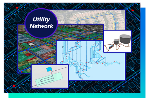
Utility Network
Utility Network is here to elevate your data quality and data accessibility. It offers agencies industry-focused configurations, an integrated network that is scalable for the organization, superior data quality control, and the only model supported for water agencies and utility agencies in the upcoming years. For more information, please visit DCSE’s Utility Network page through the link below.
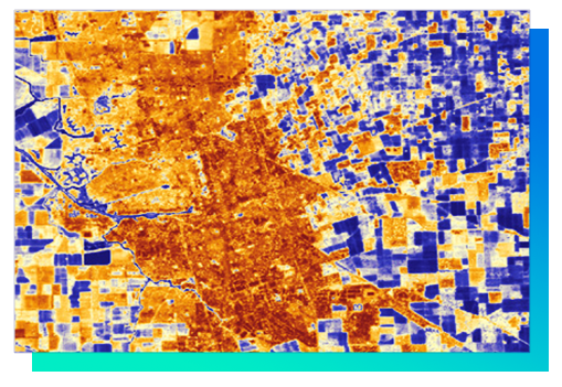
Remote Sensing & Ground Cover Analysis
By using satellite imagery and geospatial technology, remote sensing is an efficient way to gather and analyze ground information away from the source. From here, GIS maps and models can then be generated for land-use evaluation, planning and monitoring, as well as displayed in resource maps and 3D models. We provide remote sensing solutions for optimizing irrigation practices in both residential and agricultural areas.
Requirement Analysis & Needs Assessment
We can help your organization implement a sustainable enterprise GIS with fully-customized best practices, patterns and guidance when it comes to performance, security and application architecture.
Needs Assessment: A process that involves interviewing key personnel within your agency to identify important workflow activities, existing data (paper and electronic), future data needs and hardware/software requirements.
GIS Implementation: Once the needs assessment is completed, the next step is to develop a phased implementation plan based on identified needs, available data, priorities, and budgetary limitations. This should be a three- to five-year plan that outlines everything from organization structure (if you plan to have your own GIS staff), to data needs and hardware/ software requirements.

*We are uninfluenced by any GIS vendor in order to provide the best of breed solutions to our customers.
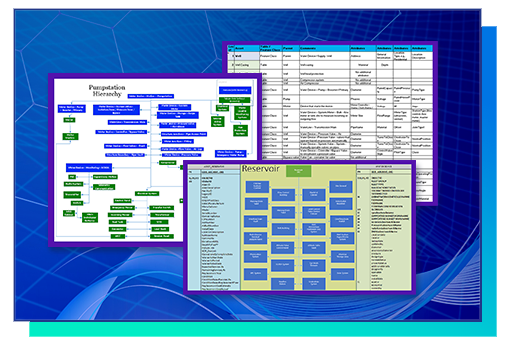
Geodatabase Design
As quality data is essential to building an enterprise GIS, we implement industry best practices to help ensure that your organization’s data is complete and accurate. From development and adaptation standards for digital mapping and metadata to modeling the data, our vast experience in spatial and tabular database design and development will ensure that quality control of your geodatabase. Our geodatabase design services are designed to meet the demand of our customers in both infrastructure maintenance as well as spatially assisted transactional systems.
Custom Applications
We can help your organization implement a sustainable enterprise GIS with fully-customized best practices, patterns and guidance when it comes to performance, security and application architecture.To get started on how we can best customize an application for your organization, please reach out to us via our website contact form.

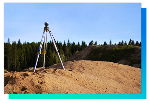
GPS Survey
If you are planning to do a GPS Project, DCSE can not only help you with data collection (subsequent integration with GIS) but can also provide rental GPS equipment for those who would prefer a more hands-on approach.
Training & Support
Training and support activities are key components of a living GIS. DCSE can recommend programs or provide training for managers, professionals, and technicians, and we are available to provide system maintenance and upgrade support following the implementation of enterprise GIS. As GIS is a living system, we recommend that any GIS plan should be revised on an annual basis – or at least every two years – to help it keep up with technology as well as the internal changes of your organization. We provide services using vendor as well as open source solutions.

REQUEST A DEMO OR MORE INFORMATION
Want to learn more information about any of the GIS Solutions shown above?
Let us know by filling out our form through the Contact Page link below.
LOCATION
DCSE Inc.
23461 S. Pointe Drive
Suite 300
Laguna Hills, CA 92653
© 2024 DCSE Inc. All Rights Reserved

